Land for sale in Llannon, Llanelli SA14


* Calls to this number will be recorded for quality, compliance and training purposes.
Property features
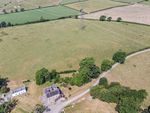
- Conveniently situated block of accommodation land
- Extending to 52.96 acres in total
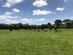
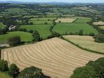
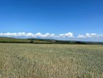
- Gently sloping south - east facing pastureland with area of improvable ground
- Suitable for grazing and cutting
- Gated access off A476 highway (Llanelli to Cross Hands road)
- Midway between the villages of Swiss Valley and Llannon
Property description
Description
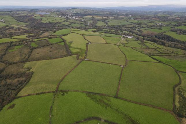
An opportunity to purchase a block of accommodation land amounting to 52.96 acres, being laid to permanent pasture suitable for grazing and cutting purposes, with areas of improvable grazing.
The land is predominantly gently sloping in nature, with areas of sloping ground, all being south easterly facing and contained within easy to manage enclosures, with strategically placed water troughs. The land is classified Grade 3b and freely draining slightly acid loamy soils, with a small area of slowly permeable seasonally wet acid loamy and clayey soils.
Situation
The land is accessed directly off the A476 highway (Llanelli to Cross Hands road), being midway between the villages of Swiss Valley and Llannon. The land is also within easy reach of the M4 corridor, with both Junctions 48 and 49 being within 5 miles equidistance.
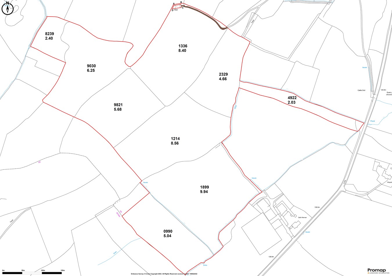
Schedule of Area
os no. - acres
8239 - 2.40
9030 - 6.25
9821 - 5.68
1214 - 8.56
1899 - 9.94
0990 - 5.04
1336 - 8.40
2329 - 4.66
4922 - 2.03
Total - 52.96 acres
Further Information
Tenure
Freehold with vacant possession upon completion.
Services
Private water supply to strategically placed water troughs.
I.A.C.S
We understand the property is registered.
Basic Payment Scheme
We understand that all the agricultural land is registered for Basic Payment Scheme.
Wayleaves, Easements and Rights of Way
The property is sold subject to and with the benefit of all rights, including rights of way, whether public or private, light, support, drainage, water, and electricity supplies and any other rights and obligations, easements and proposed wayleaves for masts, pylons, stays, cables, drains and water, gas and other pipes, whether referenced or not.
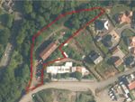
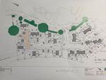
A telecommunication mast is situated on the north boundary of the land which benefits from a Right of Way over the land shaded in Brown on the attached Plan.
Plans, Areas & Schedules
A copy of the plan is attached for identification purposes only. The purchasers shall be deemed to have satisfied themselves as to the description of the property. Any error or misstatement shall not annul a sale or entitle any party to compensation in respect thereof.
Planning
All planning related enquiries to Carmarthenshire County Council Planning Department.
Local Authority
Carmarthenshire County Council, County Hall, Castle Hill, Carmarthen SA31 1JP.
Tel: Method of Sale
The land is offered for sale by Private Treaty as a whole.
What 3 Word Gateway
graceful.gourmet.gong
Viewing
Strictly by appointment with sole selling agents Rees Richards & Partners. Please contact Carmarthen office for further information - 12 Spilman Street, Carmarthen SA31 1LQ.
Tel: Email:
Property info
For more information about this property, please contact
Rees Richards & Partners, SA31 on +44 1792 738788 * (local rate)
Disclaimer
Property descriptions and related information displayed on this page, with the exclusion of Running Costs data, are marketing materials provided by Rees Richards & Partners, and do not constitute property particulars. Please contact Rees Richards & Partners for full details and further information. The Running Costs data displayed on this page are provided by PrimeLocation to give an indication of potential running costs based on various data sources. PrimeLocation does not warrant or accept any responsibility for the accuracy or completeness of the property descriptions, related information or Running Costs data provided here.
Properties on the market nearby


Marketed by
Rees Richards & Partners
(view all properties)
12 Spilman Street, Carmarthen, SA31 1LQ
- Member of:
-

-

-

-

- Monday: 09:00 - 17:00
- Tuesday: 09:00 - 17:00
- Wednesday: 09:00 - 17:00
- Thursday: 09:00 - 17:00
- Friday: 09:00 - 17:00
- Saturday: Closed
- Sunday: Closed